Kawartha Conservation Uses Drones for Erosion Control at Gateway of Lindsay
Kawartha Conservation has taken its first steps into using drone technology for erosion and sediment control, piloting the effort at the Gateway of Lindsay construction site in partnership with Bromont Homes. The project focuses on protecting Sucker Creek and other local water bodies from construction-related sediment runoff.
“This is a practical way to gather the data we need to address erosion risks,” said Brett Tregunno, Aquatic Biologist with Kawartha Conservation. “By identifying areas of concern early, we can put measures in place to reduce sediment entering waterways and protect aquatic habitats.”
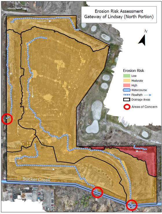
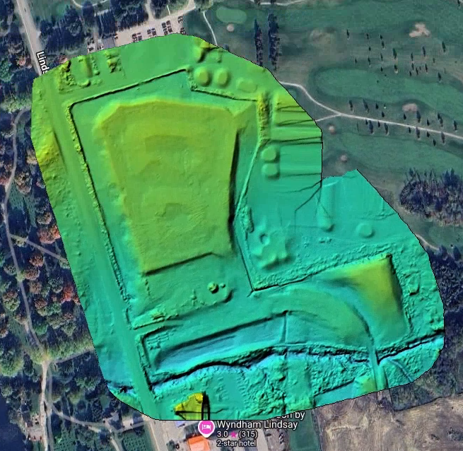
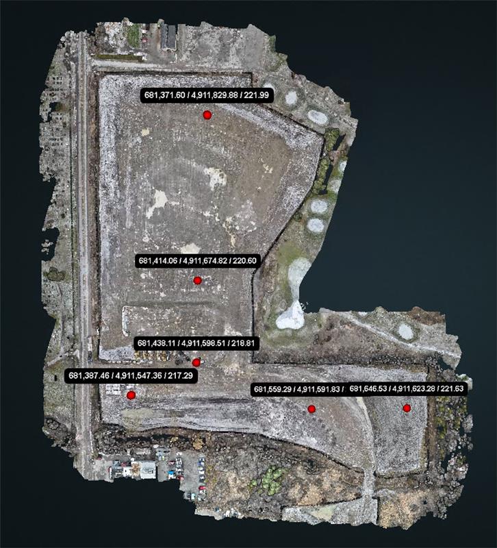
Using drones equipped with real-time kinematic (RTK) modules, Kawartha Conservation’s team mapped the site in detail, collecting data on topography, soil characteristics, and drainage patterns. The information was used to develop a digital terrain model and classify areas of erosion risk.
“The drones allowed us to quickly and accurately map the site, including its drainage flow paths and erosion-prone areas,” said Warren Dodd, Network Analyst and Administrator at Kawartha Conservation. “This technology is efficient and provides data we couldn’t easily gather with traditional methods, especially for large and complex sites.”
The assessments revealed that most of the site posed a moderate erosion risk, with one section classified as high risk. The team used these findings to recommend targeted erosion and sediment control measures to reduce potential impacts on Sucker Creek and the Scugog River.
“Understanding erosion risks through drone data has given us the ability to act decisively,” Tregunno added. “It’s an important tool in ensuring construction activities don’t harm our local water systems.”
Joe Pilatzkie, Manager of Contract Administration at Valdor Engineering Inc., said the partnership not only supports environmental health but also strengthens potential protections for the development site by providing a better understanding of where issues may arise.
"Valdor is proud to collaborate with the Conservation Authority, City, and Developer to monitor watercourses and lands, ensuring development protects the surrounding environment during construction and beyond,” he said.
This project marks a significant milestone for Kawartha Conservation as it explores the use of drones to support environmental monitoring and protection. While drones are commonly used in other sectors, this initiative represents a new way for the organization to enhance its efforts in managing erosion and sedimentation in the Kawartha Lakes watershed.
Subscribe to Receive Updates and Notifications
Stay up to date on flood and low water, news, activities, events, programs and operations by subscribing to updates and the Watershed Watch Newsletter.