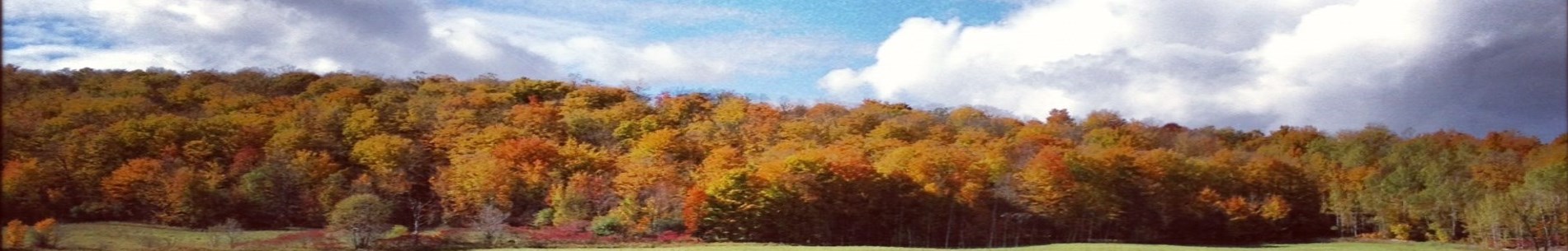
Pigeon River Headwaters Conservation Area has 3.4 km of maintained trails and boardwalks. It is a rustic natural area which provides the Pigeon River system with clean water and valuable habitat.
Pigeon River Headwaters is located at 445 Gray Road in the City of Kawartha Lakes. It is easiest to get to by going east on Gray Road from Century Farm Road. Do not take Gray Road from Highway 35.
A key ecological site within the Kawartha region that plays a crucial role in maintaining the health of the Pigeon River watershed, this conservation area spans a diverse range of natural habitats, including wetlands, forests, and meadowlands, which support a variety of wildlife and plant species. It offers visitors a peaceful environment for hiking, wildlife observation, and environmental education. As a vital resource for water quality protection and biodiversity conservation, Pigeon River Headwaters provides a natural space for both ecological research and public enjoyment.
Pigeon River Headwaters Trail Map
Parking
Parking is $4 including HST per vehicle per day, or $84.75 including HST for an annual parking pass, which includes all Kawartha Conservation conservation areas. Seniors 65 + can get an annual Parking Pass, good for any of our conservation areas for $67.80. Visitors can pay for parking using the Passport Parking Mobile App or Passport Parking website. Once you had logged in, input Zone 3183 for Pigeon River Headwaters.
The Talking Forest
Explore the trails throughout our Conservation Areas like never before, taking in the tales of trees that call the parks home. The Talking Forest is an interactive trail that allows users to hear some of the different stories the trees in our parks have to share, from the trees themselves. There are currently Talking Forest trails located at Ken Reid Conservation Area, Windy Ridge Conservation Area, and most recently Pigeon River Headwaters Conservation Area. Along the trails you will be greeted by the voices of various trees who will provide you with fun facts, historical information and may even direct you to other points of interest in the parks. Enhancements and development of The Talking Forest are supported by the RBC Tech for Nature program. Download the app today to see what the trees have to say.
The Talking Forest app is free to download and is currently available on Android and IOS platforms. Subscribe to this page for updates on The Talking Forest and new trails.
Trail Information
Pigeon River Headwaters
- 7 Stations located along the Brown Trail
- Approximate total length of trail: 1 km
Join the fun, download the app

- Visit the Google Play Store or App Store.
- Search for and download "The Talking Forest" app.
- Make sure your location services are turned on. This allows you to follow along the trail.
- Select the talking trail you would like to follow.
- Leave your phone in your pocket as you explore the trails or use it as a guide to help pinpoint stops along the trail.
- Turn your volume up and listen carefully.
Download The Talking Forest for Android.
Download The Talking Forest for Apple.
Tell us what you think
Have you tried The Talking Forest? We want to hear your thoughts. Take a minute to provide us with feedback from your experience on the trail.
Facilities
Pigeon River Headwaters offers:
- Parking
- Portable washroom
- Picnic shelter
- Garbage can
Activities
Things to do at Pigeon River Headwaters:
- Hike and bike the 3.4 km trail system
- Walk your dog on leash
- Bird in the forests and wetlands
- Visit the scenic lookout along the boardwalk
- Cross-country ski or snowshoe (trails not maintained in the winter)
Getting here
Pigeon River Headwaters is located at 445 Gray Road (take Gray Road from Century Farm Road) in the City of Kawartha Lakes. It is easiest to get to by going east on Gray Road from Century Farm Road.
Do not take Gray Road from Highway 35
About
In 1987, Ross Davidson of Toronto donated the 308 acre land that makes up Pigeon River Headwaters today. The park is partly on the Oak Ridges Moraine. The cold water supports sensitive Brook trout. The boardwalk surrounds a marsh full of native plant species, reptiles, amphibians and birds.