Close Alert Banner
Skip to Content

Kawartha Conservation Logo Kawartha Conservation Print Logo

Normal
Watershed Conditions Statement
Flood Watch
Flood Warning
Normal
Level I
Level II
Level III
  • Conservation Areas

    Conservation Areas

    • Durham East Cross Forest
    • Event Calendar
    • Fleetwood Creek
    • Ken Reid
    • Off-Leash Dog Park
    • Pigeon River Headwaters
    • Report an Issue
    • Windy Ridge
    • The Talking Forest
    • Kawartha Quest
    • Spring in the Kawartha Watershed
    • Disc Golf
    View our Durham East Cross Forest page
  • Permits and Planning

    Permits and Planning

    • Apply for a Permit
    • Book a Pre-Consultation Meeting
    • Event Calendar
    • Flood Plain Mapping
    • Planning Services
    • Property Information Requests
    • Property Mapping
    • Report a Violation
    • Source Protection Notice
    • Sediment and Erosion Control
    View our Property Mapping page
  • Landowner Services

    Landowner Services

    • Erosion and Shoreline Protection
    • Event Calendar
    • Farm Management
    • Healthy Gardens
    • Community Grants
    • Landowner Grants
    • Septic Systems and Wells
    • Tree Planting
    View our Tree Planting page
  • Learn and
    Get Involved

    Learn and Get Involved

    • Birding
    • Careers and Volunteering
    • Festivals
    • Citizen Science
    • Donations
    • Kawartha Conservation Foundation
    • Learn at Home
    • Nature Camps
    • News and Events
    • Professional Development
    • Students and Teachers
    • The Talking Forest
    • Spring time in the Kawartha Watershed
    • Kawartha Quest
    View our Kawartha Conservation Foundation page
  • Environmental Sciences

    Environmental Sciences

    • Climate Change
    • Data Requests and Maps
    • Drinking Water Source Protection
    • Flood Forecasting and Warning
    • Flood Plain Mapping
    • Lake and Environmental Management Plans
    • Lake Scugog Enhancement Project
    • Low Water and Droughts
    • Understanding your Watershed
    • Watershed Monitoring
    • Know Your Signs
    • Environmental Monitoring Strategy
    • Watershed Report Cards
    View our Cameron Lake page
  • About Us

    About Us

    • Accessibility
    • Board Meeting Calendar
    • Governance
    • Careers and Volunteering
    • Contact Us
    • Donations
    • Event Calendar
    • Online Store
    • Our Partners
    • Plans and Reports
    • Report an Issue
    • Who We Are
    • Bids and Tenders
    • Connect with Us Online
    View our Careers and Volunteering page
Contact Us

Wetland, tall grass and water

Watershed Report Cards

HomeEnvironmental SciencesWatershed Report Cards
  • Open new window to share this page via Facebook Facebook
  • Open new window to share this page via Twitter Twitter
  • Open new window to share this page via Pinterest Pinterest
  • Open new window to share this page via LinkedIn LinkedIn
  • Email this page Email

In 2012, Conservation Authorities developed a set of guidelines to assist with the standardizing of Watershed Report Cards across the province. Kawartha Conservation monitors the health of natural resources in our watershed and generates a Watershed Report Card every 5 years along with the other 36 Conservation Authorities.

Through the watershed report cards, Kawartha Conservation monitors four resource categories, including surface water quality, groundwater quality, forest conditions and wetland cover, assigning a grade to each category.

Click here to view the 2023 Watershed Report Card 


Overall, what did we learn about the Kawartha Watershed? 

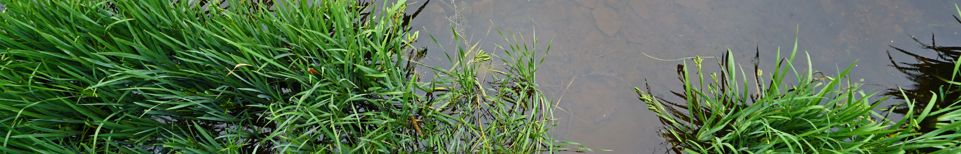
Surface Water Quality - "C"
  • Water Quality grades for lakes ranged from A to B, with mostly A grades.
  • Water quality grades for rivers and streams ranged from B to D, with mostly D grades.
  • *E. coli was only measured in the Balsam Lake, Cameron Lake, Pigeon Lake, and Lake Scugog subwatersheds.
  • Benthic invertebrate sampling primarily took place in streams flowing through the urban areas of Lindsay, Port Perry, Fenelon Falls, Bobcaygeon, and Omemee.  Streams with lower grades generally produced more pollutant-tolerant species such as the aquatic sowbug.
  • Due to shift in monitoring objectives, there are various subwatersheds that do not have sufficient data to satisfy the criteria of the Watershed Report Card scoring system.
Forest Conditions - "C"
  • Grades ranged from A to F, with mostly C grades.
  • The Balsam Lake, Cameron Lake, Mariposa Brook, and McLarens Creek subwatersheds received a lower grade in comparison to the 2018 Watershed Report Card due to the loss of forested land caused by different land use pressures.
  • Kawartha Conservation’s watershed benefits from 33% forest cover.
  • Watersheds with less than 30% forest cover provide limited support to aquatic systems and habitat, which leads to decreased water quality and biodiversity, limited recreational opportunities, and more.
  • *Forest grades were derived using 2018 imagery, which was the best available data at the time of publishing but may not reflect present day conditions. Contact Kawartha Conservation to learn more.
Groundwater Quality - "B"
  • Due to unforeseen equipment malfunctions, 3 of the 10 monitoring wells had insufficient data. Impacted monitoring stations include two wells in the north and south of Durham East Cross Forest, and one in Pontypool.
  • Groundwater quality grades for nitrate + nitrite ranged from A to B, with mostly A grades. Levels of nitrate + nitrite met the Ontario Drinking Water Standards, indicating good water quality.
  • Groundwater quality grades for chloride ranged from A to F, with mostly A grades. However, chloride levels in some areas are approaching or have exceeded the Canadian Drinking Water Guidelines, suggesting possible groundwater contamination through winter salt application.
  • The quality of your private well water may vary from that of the provincial monitoring wells.
Wetland Cover - B"
  • Grades ranged from A to F, with mostly A grades.
  • The Cameron Lake and Pigeon Lake subwatersheds received a lower grade in comparison to the 2018 Watershed Report Card due to the loss of wetlands caused by different land use pressures.
  • Kawartha Conservation’s watershed benefits from 15.4% wetland cover.
  • Watersheds with less than 10% wetland cover are at risk for increased flooding, decreased biodiversity and water quality, which is why it is important to protect and restore wetlands within our region.
  • *Wetland grades were derived using 2018 imagery, which was the best available data at the time of publishing but may not reflect present day conditions. Contact Kawartha Conservation to learn more.
Previous Report Cards
  • 2018 Watershed Report Card
  • 2013 Watershed Report Card
  • 2008 Watershed Report Card
  • 2015 Oak Ridges Moraine and Greenbelt Report Card

Use the interactive watershed map above to take a closer look at the individual lakes and watershed areas. Use the drop down in the top right corner to change between Surface Water Quality, Groundwater Quality, Forest Conditions and Wetland Cover.

What is a Watershed?

A watershed is the area of land that catches rain and snow and drains or seeps into a marsh, stream, river, lake or groundwater. Watersheds are the collectors, filters, conveyers and storage compartments of our fresh water supply.

Map showing a watershed and how water flows and is impacted by its surroundings.

       * Illustration courtesy of Toronto and Region Conservation Authority

To view all 36 Conservation Authorities Watershed Report Cards please visit www.watershedcheckup.ca

Environmental Sciences
    • Climate Change
    • Data Requests and Maps
    • Drinking Water Source Protection
    • Flood Forecasting and Warning
    • Flood Plain Mapping
    • Lake and Environmental Management Plans
    • Lake Scugog Enhancement Project
    • Low Water and Droughts
    • Understanding your Watershed
      Toggle Section Understanding your Watershed Menu
      • Balsam Lake
      • Blackstock Creek
      • Cameron Lake
      • Cawkers Creek
      • East Cross Creek
      • Emily Creek
      • Fleetwood Creek
      • Hawkers Creek
      • Janetville Creek
      • Jennings Creek
      • Lake Scugog
      • Layton River
      • Mariposa Brook
      • Martin Creek North
      • Martin Creek South
      • McLarens Creek
      • Nogies Creek
      • Nonquon River
      • Pearns Creek
      • Pigeon Lake
      • Pigeon River
      • Rutherford Creek
      • Scugog River
      • South Lake Scugog
      • Staples River
      • Stoney Creek
      • Sturgeon Lake
    • Watershed Monitoring
    • Know Your Signs
    • Environmental Monitoring Strategy
    • Watershed Report Cards

Contact Us

Subscribe to this page
  • Report an Issue
  • Accessibility
  • Careers
  • Store
  • Contact Us

Kawartha Conservation Footer Logo

© 2020 Kawartha Conservation

  • Freedom of Information
  • Privacy Policy
  • Sitemap
  • Website Feedback

Follow Us

View our Facebook Page View our Twitter Page View our Instagram Page View our YouTube Page View our LinkedIn Page

Immigration, Refugees and Citizenship Canada logo

With the support of the Government of Canada through the Federal Economic Development Agency for Southern Ontario

Designed by eSolutionsGroup

Close Old Browser Notification
Browser Compatibility Notification
It appears you are trying to access this site using an outdated browser. As a result, parts of the site may not function properly for you. We recommend updating your browser to its most recent version at your earliest convenience.