Close Alert Banner
Skip to Content

Kawartha Conservation Logo Kawartha Conservation Print Logo

Normal
Watershed Conditions Statement
Flood Watch
Flood Warning
Normal
Level I
Level II
Level III
  • Conservation Areas

    Conservation Areas

    • Durham East Cross Forest
    • Event Calendar
    • Fleetwood Creek
    • Ken Reid
    • Off-Leash Dog Park
    • Pigeon River Headwaters
    • Report an Issue
    • Windy Ridge
    • The Talking Forest
    • Kawartha Quest
    • Spring in the Kawartha Watershed
    • Disc Golf
    View our Durham East Cross Forest page
  • Permits and Planning

    Permits and Planning

    • Apply for a Permit
    • Book a Pre-Consultation Meeting
    • Event Calendar
    • Flood Plain Mapping
    • Planning Services
    • Property Information Requests
    • Property Mapping
    • Report a Violation
    • Source Protection Notice
    • Sediment and Erosion Control
    View our Property Mapping page
  • Landowner Services

    Landowner Services

    • Erosion and Shoreline Protection
    • Event Calendar
    • Farm Management
    • Healthy Gardens
    • Community Grants
    • Landowner Grants
    • Septic Systems and Wells
    • Tree Planting
    View our Tree Planting page
  • Learn and
    Get Involved

    Learn and Get Involved

    • Birding
    • Careers and Volunteering
    • Festivals
    • Citizen Science
    • Donations
    • Kawartha Conservation Foundation
    • Learn at Home
    • Nature Camps
    • News and Events
    • Professional Development
    • Students and Teachers
    • The Talking Forest
    • Spring time in the Kawartha Watershed
    • Kawartha Quest
    View our Kawartha Conservation Foundation page
  • Environmental Sciences

    Environmental Sciences

    • Climate Change
    • Data Requests and Maps
    • Drinking Water Source Protection
    • Flood Forecasting and Warning
    • Flood Plain Mapping
    • Lake and Environmental Management Plans
    • Lake Scugog Enhancement Project
    • Low Water and Droughts
    • Understanding your Watershed
    • Watershed Monitoring
    • Know Your Signs
    • Environmental Monitoring Strategy
    • Watershed Report Cards
    View our Cameron Lake page
  • About Us

    About Us

    • Accessibility
    • Board Meeting Calendar
    • Governance
    • Careers and Volunteering
    • Contact Us
    • Donations
    • Event Calendar
    • Online Store
    • Our Partners
    • Plans and Reports
    • Report an Issue
    • Who We Are
    • Bids and Tenders
    • Connect with Us Online
    View our Careers and Volunteering page
Contact Us

Interior banner

Lake and Environmental Management Plans

HomeEnvironmental SciencesLake and Environmental Management Plans
  • Open new window to share this page via Facebook Facebook
  • Open new window to share this page via Twitter Twitter
  • Open new window to share this page via Pinterest Pinterest
  • Open new window to share this page via LinkedIn LinkedIn
  • Email this page Email

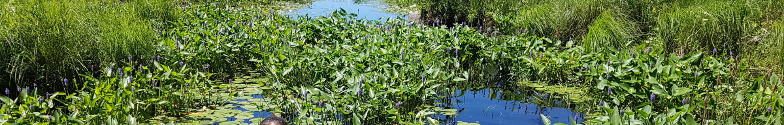
Environmental management plans provide a framework for establishing goals, objectives and direction for the protection of water resources, the management of human activities, land, water, aquatic life and resources within a watershed.

The plans provide a scientific and community-based approach to protecting our water resources over the short and long terms, and typically involve detailed inventories of landscapes, rivers, and lakes and extensive collaboration with community stakeholders.

Plan implementation

By undertaking the recommendations in the various management plans, we can ensure a healthy economy, quality of life and environment for current and future generations.

View implementation project sites and project details by clicking on each location shown on the impact online map.

Get involved

Join the team and make an impact in your watershed!

Make an impact

Visit landowner services to learn more about how we can help you undertake a project on your property or in your community.

Lake plans

Our lakes are directly connected to the Trent-Severn Waterway National Historic Site and are highly valued for providing significant economic, social and ecological benefits to those who live, work and enjoy recreation in the Kawartha Lakes region.

Kawartha Conservation has developed the following lake management plans.

Balsam and Cameron Lakes

Review the Balsam Lake and Cameron Lake Management Plan and the Balsam Lake and Cameron Lake Watershed Characterization Report.

Canal and Mitchell Lakes

Review the Canal and Mitchell Lakes, Talbot River, and Whites Creek Subwatershed Plan and the Canal and Mitchell Lakes, Talbot River, and Whites Creek Implementation Plan. These plans were created in partnership with the Lake Simcoe Region Conservation Authority and includes the Talbot River and Whites Creek Subwatersheds.

Four Mile Lake

Review the Four Mile Lake Management Plan and Four Mile Lake Watershed Characterization Report.

Head Lake

Review the Head Lake and Rush Lake Management Plan and Head Lake and Rush Lake Watershed Characterization Report.

Lake Dalrymple

Kawartha Conservation and the City of Kawartha Lakes are partnering on a 4 year (2021-2024) science-based lake management planning project for Lake Dalrymple and its watershed.
Learn more about the Lake Dalrymple Management Plan.

Lake Scugog

Review the Lake Scugog Environmental Management Plan.

Pigeon Lake

Review the Pigeon Lake Management Plan and Pigeon Lake Watershed Characterization Report.

Shadow Lake

Review the Shadow Lake and Silver Lake Management Plan and Shadow Lake and Silver Lake Watershed Characterization Report.

Sturgeon Lake

Review the Sturgeon Lake Management Plan and Sturgeon Lake Watershed Characterization Report.

Fisheries plans

Healthy fish communities and the aquatic habitats on which they rely provide significant ecological and recreational benefits to local communities.

Kawartha Conservation has developed the following fisheries management plan:

  • Nonquon River Fisheries Management Plan

Oak Ridges Moraine plans

The Oak Ridges Moraine is a significant land feature in Ontario that is important because of its unique concentration of environmental, geological and hydrological characteristics.

Review the plans for the Oak Ridges Moraine watershed:

  • Blackstock Creek Watershed Management Plan and Blackstock Creek Watershed Characterization Report
  • East Cross Creek Subwatershed Management Plan and East Cross Creek Subwatershed Characterization Report
  • Nonquon River Watershed Management Plan and Nonquon River Watershed Characterization Report
  • Southern Lake Scugog Tributaries Watershed Management Plan and Southern Lake Scugog Tributaries Watershed Characterization Report

Stormwater plans

Urban areas greatly impact the hydrologic cycle and are major contributors of contaminants to water systems. A significant proportion of these contaminants can be attributed to stormwater runoff.

Kawartha Conservation has developed the following stormwater management plan:

  • Port Perry Stormwater Management Plan
Environmental Sciences
    • Climate Change
    • Data Requests and Maps
    • Drinking Water Source Protection
    • Flood Forecasting and Warning
    • Flood Plain Mapping
    • Lake and Environmental Management Plans
    • Lake Scugog Enhancement Project
    • Low Water and Droughts
    • Understanding your Watershed
      Toggle Section Understanding your Watershed Menu
      • Balsam Lake
      • Blackstock Creek
      • Cameron Lake
      • Cawkers Creek
      • East Cross Creek
      • Emily Creek
      • Fleetwood Creek
      • Hawkers Creek
      • Janetville Creek
      • Jennings Creek
      • Lake Scugog
      • Layton River
      • Mariposa Brook
      • Martin Creek North
      • Martin Creek South
      • McLarens Creek
      • Nogies Creek
      • Nonquon River
      • Pearns Creek
      • Pigeon Lake
      • Pigeon River
      • Rutherford Creek
      • Scugog River
      • South Lake Scugog
      • Staples River
      • Stoney Creek
      • Sturgeon Lake
    • Watershed Monitoring
    • Know Your Signs
    • Environmental Monitoring Strategy
    • Watershed Report Cards

Contact Us

Subscribe to this page
  • Report an Issue
  • Accessibility
  • Careers
  • Store
  • Contact Us

Kawartha Conservation Footer Logo

© 2020 Kawartha Conservation

  • Freedom of Information
  • Privacy Policy
  • Sitemap
  • Website Feedback

Follow Us

View our Facebook Page View our Twitter Page View our Instagram Page View our YouTube Page View our LinkedIn Page

Immigration, Refugees and Citizenship Canada logo

With the support of the Government of Canada through the Federal Economic Development Agency for Southern Ontario

Designed by eSolutionsGroup

Close Old Browser Notification
Browser Compatibility Notification
It appears you are trying to access this site using an outdated browser. As a result, parts of the site may not function properly for you. We recommend updating your browser to its most recent version at your earliest convenience.