Close Alert Banner
Skip to Content

Kawartha Conservation Logo Kawartha Conservation Print Logo

Normal
Watershed Conditions Statement
Flood Watch
Flood Warning
Normal
Level I
Level II
Level III
  • Conservation Areas

    Conservation Areas

    • Durham East Cross Forest
    • Event Calendar
    • Fleetwood Creek
    • Ken Reid
    • Off-Leash Dog Park
    • Pigeon River Headwaters
    • Report an Issue
    • Windy Ridge
    • Winter in the Kawarthas
    • The Talking Forest
    • Kawartha Quest
    • Disc Golf
    View our Durham East Cross Forest page
  • Permits and Planning

    Permits and Planning

    • Apply for a Permit
    • Book a Pre-Consultation Meeting
    • Event Calendar
    • Flood Plain Mapping
    • Planning Services
    • Property Information Requests
    • Property Mapping
    • Report a Violation
    • Source Protection Notice
    • Sediment and Erosion Control
    View our Property Mapping page
  • Landowner Services

    Landowner Services

    • Erosion and Shoreline Protection
    • Event Calendar
    • Farm Management
    • Healthy Gardens
    • Community Grants
    • Landowner Grants
    • Septic Systems and Wells
    • Tree Planting
    • Talbot River Healthy Environment Initiative
    View our Tree Planting page
  • Learn and
    Get Involved

    Learn and Get Involved

    • Birding
    • Careers and Volunteering
    • Festivals
    • Citizen Science
    • Donations
    • Kawartha Conservation Foundation
    • Learn at Home
    • Nature Camps
    • News and Events
    • Professional Development
    • Students and Teachers
    • The Talking Forest
    View our Kawartha Conservation Foundation page
  • Environmental Sciences

    Environmental Sciences

    • Climate Change
    • Data Requests and Maps
    • Drinking Water Source Protection
    • Flood Forecasting and Warning
    • Flood Plain Mapping
    • Lake and Environmental Management Plans
    • Lake Scugog Enhancement Project
    • Low Water and Droughts
    • Understanding your Watershed
    • Watershed Monitoring
    • Know Your Signs
    • Environmental Monitoring Strategy
    View our Cameron Lake page
  • About Us

    About Us

    • Accessibility
    • Board Meeting Calendar
    • Governance
    • Careers and Volunteering
    • Contact Us
    • Donations
    • Event Calendar
    • Online Store
    • Our Partners
    • Plans and Reports
    • Report an Issue
    • Who We Are
    • Bids and Tenders
    • Connect with Us Online
    View our Careers and Volunteering page
Contact Us

Pylons indicating road is closed due to flooding

Flood Forecasting and Warning

HomeEnvironmental SciencesFlood Forecasting and Warning
  • Open new window to share this page via Facebook Facebook
  • Open new window to share this page via Twitter Twitter
  • Open new window to share this page via Pinterest Pinterest
  • Open new window to share this page via LinkedIn LinkedIn
  • Email this page Email

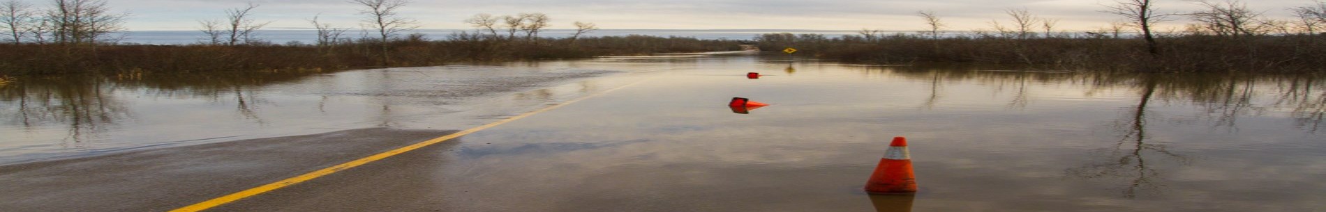
Flood forecasting is one of the most important services that Kawartha Conservation provides to our residents and member municipalities. A timely warning of upcoming high-water conditions is critical to helping everybody to prepare and be better able to respond.

Flood messages

Our flood messages are sent to the media, posted on our website and shared on our social media channels. You can subscribe to receive Kawartha Conservation flood messages via email.

The following colour-coded symbols describe the watershed conditions. This is always indicated throughout our website.

Normal

Normal status indicates that no flood conditions exist. However, even during normal conditions, the inherent risk to personal safety associated with flowing water still exists.

example of multi colour image highlighting Normal

Watershed Conditions Statement

There are two types of Watershed Conditions Statements: Water Safety and Flood Outlook.

Watershed Conditions Statement - Water Safety

A Water Safety message implies the unsafe conditions on the local watercourses. High flows, unsafe banks, melting ice, or other factors that could be dangerous for recreational users such as anglers, canoeists, hikers, children, pets, etc. Flooding is not expected.

example of multi colour image highlighting Water Safety

Watershed Conditions Statement - Flood Outlook

A Flood Outlook message is an early notice of the potential for flooding based on weather forecasts calling for:

  • Heavy rain
  • Snow melt
  • Other conditions that could lead to high runoff, ice jams, lakeshore flooding, or erosion

example of multi colour image highlighting Flood Outlook

Flood Watch

A Flood Watch warns that flooding is possible. Municipalities, emergency services, and individual landowners in flood-prone areas should prepare. A Flood Watch may be issued for specific waterbodies or municipalities.

example of multi colour image highlighting Flood Watch

Flood Warning

A Flood Warning advises that flooding is imminent or already occurring. A Flood Warning may be issued for specific waterbodies or municipalities.

example of multi colour image highlighting Flood Warning

Flood response

If your life is in danger call 911 immediately.

For assistance in the event of a flood, please contact your municipality directly:

  • City of Kawartha Lakes
  • Durham Region
  • Township of Scugog
  • Township of Brock
  • Municipality of Trent Lakes
  • Township of Cavan Monaghan
  • Municipality of Clarington

Your local municipality provides flood response measures such as road closures, possible help with sandbagging and evacuation if required.

Contact us for more information about flood conditions in the area or to report flooding.

For information about flooding on the Burnt and Gull Rivers please contact the NDMNRF - Minden Area office.

Kawartha Lakes full-time and seasonal residents can also stay up-to-date while on the go by downloading the mobile app, Pingstreet. The app provides residents with access to latest news and events, emergency notifications and more.

Apple App Store logo Google play logo

Flood preparedness

If you own property or live in a floodplain, here are some steps you can take to deal with flooding.

Prepare your property

You can prepare your property for a flood by:

  • Installing a sump pump and zero reverse flow valves in basement floor drains
  • Having a portable generator and pump available and make sure they are working
  • Moving important items that may be subject to flooding to upper levels
  • Consulting your electricity and fuel suppliers (oil, natural gas, propane) for instructions on how to safely shut down and protect furnaces and other equipment, and the steps that need to be taken after a flood before restarting equipment
  • Consulting your property insurer about steps you should take if your property is flooded

When a flood is imminent or occurring

Take these steps during a flood to reduce the amount of damage and stay safe:

  • Remove valuable items from the basement
  • Follow the instructions from your utility supplier (gas, electrical, propane, etc.) to safely shut down and protect furnaces and other appliances.
  • Prepare to evacuate if necessary
  • Collect necessary items such as cash, medication, important papers, identification and change of clothes
  • Consider evacuating your residence if streets in your neighbourhood are flooded
  • Resist the urge to tour flooded areas. You may be putting your own life at risk and could interfere with the work of emergency responders.
  • Ensure your pets are not left alone during a flood by taking them to a kennel or leaving them with family and friends
  • If a road has been closed, obey the signs and take alternate routes

After a flood

Follow these tips after a flood to help reduce damage:

  • Do not return home until authorities advise it is safe
  • Report broken utility lines
  • Consult your insurer about steps to take if your property is flooded
  • If you suspect your building has suffered structural damage, contact the building department of your municipality
  • If the main power switch was not turned off prior to flooding, do not re-enter your home until a qualified electrician has determined it is safe to do so
  • If your main electrical panel was under water, it must be cleaned, dried and tested by a qualified electrician to determine if it is safe
  • Do not use flooded appliances, electrical outlets, switch boxes or fuse breaker panels until they have been checked by the power company
  • If natural gas lines were under water, contact your gas supplier before resuming service
  • If natural gas appliances were under water, have them checked by an approved heating, ventilation and air conditioning contractor
  • The water in your home could be contaminated with sewage and other pollutants. Contact the local health unit for instructions.

Our jurisdiction and partners

We forecast high water levels and flooding in local creeks, rivers and lakes within our watershed. Neighbouring conservation authorities look after creeks in their respective areas. Where there are no conservation authorities, such as in the area to the north of Kawartha Conservation where the Burnt and Gull Rivers flow, the Ministry of Northern Development, Mines, Natural Resources and Forestry (MNRF) provides flood forecasting.

As the Trent-Severn Waterway (TSW) makes its way through the Kawartha Conservation watershed we work with Parks Canada. The large dams on Balsam, Cameron, Sturgeon, Pigeon Lake and Lake Scugog that regulate those lakes' levels are all owned and operated by the TSW. The agency also oversees the small dams on the Burnt and Gull Rivers and its tributaries.

In our flood forecasting and warning operations we work very closely with our partners to provide accurate and timely forecasts.

Monitoring network

To predict flooding we watch rivers and lakes, ground conditions and weather across the watershed 24-hours a day, 365 days a year. Our monitoring network includes water level gauges, precipitation and other weather parameters gauges and snow courses. For weather forecast we use information from the Ministry of Natural Resources and Forestry and Environment and Climate Change Canada.

The monitoring network across the watershed includes:

  • Five streamflow gauges
  • Five lake water level gauges
  • Five rainfall gauges
  • Three total precipitation locations, measuring snow, rain and mixed precipitation
  • Four snow courses

To see the available data, visit Watershed Monitoring page.

Related links

For more information about flooding, check out these resources.

Flood information

Review these resources for more flood information:

  • City of Kawartha Lakes Flood Information
  • Region of Durham Emergency Management
  • Trent-Severn Waterway Water Management Updates
  • Current Flood Message - Ministry of Natural Resources
  • Conservation Ontario Flood Forecasting and Warning Information

Flood preparation

To help with flood preparation, review these resources:

  • Emergency Management Ontario
  • Public Safety Canada
  • Backgrounder on Floods - Ontario Ministry of Natural Resources
  • How to build a sandbag dike

Water levels

You can find information about current water levels at the following webpages:

  • Water levels – Balsam Lake
  • Water levels – Cameron Lake
  • Water levels – Sturgeon Lake
  • Water levels – Pigeon Lake (Buckhorn Lake)
  • Water levels – Lake Scugog
  • Water levels – Blackstock Creek near Blackstock
  • Water levels – Nonquon River near Port Perry
  • Water levels – Pigeon River near Lotus
  • Water levels – Mariposa Brook near Little Britain
  • Water levels – Pigeon River at Omemee
  • Water levels – Burnt River near Burnt River
  • Water levels – Gull River at Norland

Weather

Check the weather forecast regularly to help identify flood conditions:

  • Kawartha Lakes current/extended forecasts - Environment Canada
  • Kawartha Lakes current/extended forecasts - Weather Network
Environmental Sciences
    • Climate Change
    • Data Requests and Maps
    • Drinking Water Source Protection
    • Flood Forecasting and Warning
    • Flood Plain Mapping
    • Lake and Environmental Management Plans
    • Lake Scugog Enhancement Project
    • Low Water and Droughts
    • Understanding your Watershed
      Toggle Section Understanding your Watershed Menu
      • Balsam Lake
      • Blackstock Creek
      • Cameron Lake
      • Cawkers Creek
      • East Cross Creek
      • Emily Creek
      • Fleetwood Creek
      • Hawkers Creek
      • Janetville Creek
      • Jennings Creek
      • Lake Scugog
      • Layton River
      • Mariposa Brook
      • Martin Creek North
      • Martin Creek South
      • McLarens Creek
      • Nogies Creek
      • Nonquon River
      • Pearns Creek
      • Pigeon Lake
      • Pigeon River
      • Rutherford Creek
      • Scugog River
      • South Lake Scugog
      • Staples River
      • Stoney Creek
      • Sturgeon Lake
    • Watershed Monitoring
    • Know Your Signs
    • Environmental Monitoring Strategy

Contact Us

Subscribe to this page
  • Report an Issue
  • Accessibility
  • Careers
  • Store
  • Contact Us

Kawartha Conservation Footer Logo

© 2020 Kawartha Conservation

  • Freedom of Information
  • Privacy Policy
  • Sitemap
  • Website Feedback

Follow Us

View our Facebook Page View our Twitter Page View our Instagram Page View our YouTube Page View our LinkedIn Page

Immigration, Refugees and Citizenship Canada logo

With the support of the Government of Canada through the Federal Economic Development Agency for Southern Ontario

Designed by eSolutionsGroup

Close Old Browser Notification
Browser Compatibility Notification
It appears you are trying to access this site using an outdated browser. As a result, parts of the site may not function properly for you. We recommend updating your browser to its most recent version at your earliest convenience.